Interactive Government Data Visualisation
Roads from Above
Visualising machine learning CNN for engineering workflows.
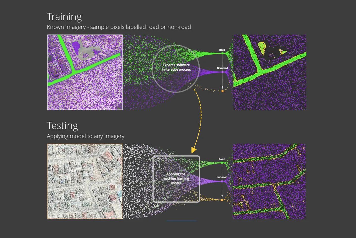
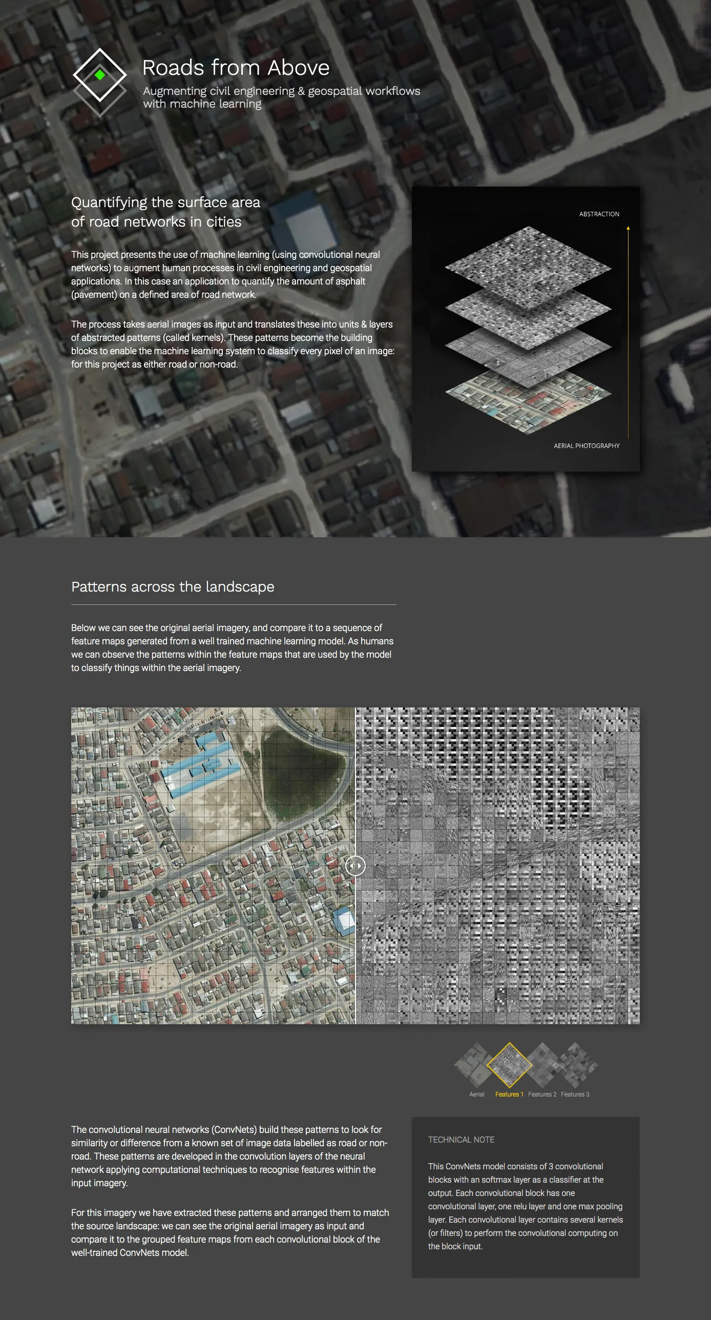
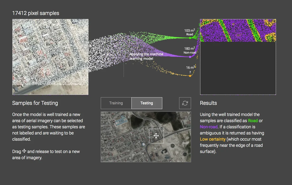
With Aurecon Engineering a project that presents the use of machine learning (using convolutional neural networks) to augment human processes in civil engineering and geospatial applications. In this case an application to quantify the amount of asphalt (pavement) on a defined area of road network.
Recognition
Received honourable mention VISxAI 2018 IEEE, Berlin. Visit VISxAI
Project Team
See project credits on the project website, open website.